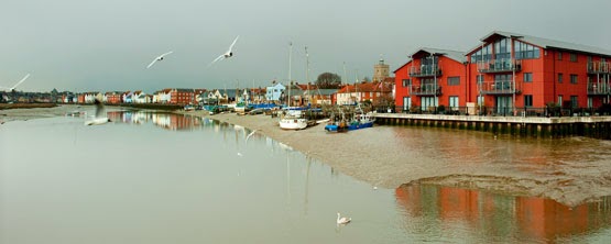
Wivenhoe, a small and characterful town popular with artists seemed a good place to begin my exploration of the Colne Estuary. It is home to one of my favourite marine artists,
James Dodds, who has beautifully captured the essence of this riverside town in his linocut "Wivenhoe past and present". Complex in detail this image portrays the relationship between the town and the estuary and illustrates the reliance on the waterway that has grown and developed over many centuries.
Wivenhoe lies on the east shore of the estuary about 3 miles south east of Colchester where it developed as a port for its larger neighbour. The town was recorded in the Domesday book of 1086 but really established it's significance with the growth of its fishing and shipbuilding industries. In the 18th Century the towns upstream shipyard built a succession of fishing smacks and cargo vessels, a ropery flourished and the fishing fleet landed sprats and oysters. By the end of the 19th century a dry dock had been build and commercial vessels constructed from riveted metal plate were the order of the day. Unfortunately after the war the shipbuilding industry went into decline and the yards at Wivenhoe eventually closed in 1992.
Today Wivenhoe is a picturesque waterside town, a successful blend of traditional architecture and modern waterside living.
 |
| Wivenhoe Waterfront |
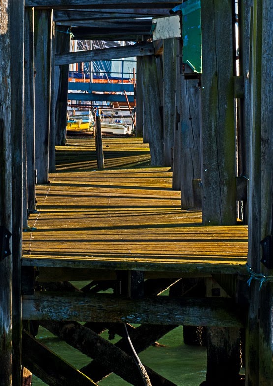
The waterfront is full of character and colour and it is easy to see why this place has become so popular with the artistic community. Sailing boats and fishing vessels line the waterfront watched over by a mixture of quaint old buildings and modern apartments. There is an air of affluence here among the modern waterfront which contrasts nicely with the muddy estuary and the more rustic shoreline.
 |
| Wivenhoe |
Half way along the front is the
Nottage Maritime Museum a fantastic place for learning about boat-building and nautical skills. It also houses an amazing collection of memorabilia relating to the River Colne and is open on most Sundays during the summer months.
As you stroll further along the shoreline you eventually reach the Colne tidal barrier which was built in 1993 to protect the town and surrounding land from tidal and storm surge flooding. It is a huge concrete and steel structure and looks imposing and out of place in its surroundings. Beyond the barrier lies Wivenhoe Sailing Club and an estuary that immediately becomes wild and unoccupied.
 |
| Colne Estuary from Wivenhoe Sailing Club |
From Wivenhoe the Colne flows through muddy banks alive with the sound of waders, twisting and turning on its journey to the coast.
The bustling town of Brightlingsea lies at the mouth of the Colne Estuary on the junction with Brightlingsea Creek. Although not a large settlement the town has an importance as a port which goes back to the eleven hundreds when the Confederation of Cinque Ports was established. This consisted of 5 towns along the South Coast and 23 connected towns and villages known as" limbs" and Brightlingsea became a limb for the Cinque Port of Sandwich. The Cinque ports were originally formed for military and trade purposes however their significance today is purely ceremonial.
Brightlingsea is a happy place full of activity. It is a town which delights in its connections with the water and the estuary that it sits along side. There is a strong watersports scene here with two sailing clubs and a rowing club situated along the waterfront and a multitude of water based businesses around the town.
 |
| Brightlingsea Waterfront |
The main harbour lies opposite the town centre and is a hub of activity. To the left of the Colne sailing club is the Aldous Heritage Smack Dock; a site acquired for the preservation and conservation of these graceful working boats.
At the far end of town the promenade, backed by a row of colourful beach huts, leads out to Batemans tower a folly built in 1883. From its position at the mouth of the estuary it is possible to see right across to Stone point in one direction and Mersea Island in the other.
 |
| Batemans Tower |
 |
| Batemans Tower |
Colne Estuary Facts
OS Explorer map 184
The Colne Estuary is an important habitat for wildlife and is one of the most protected areas on the East Coast. It comprises a variety of different habitats including:
Tidal mud flats 30%
Salt marshes 25%
Freshwater marshes 20%
Estuarine waters 19%
Sand / shingle shores (including dune systems) 3%
Coastal brackish / saline lagoons 2%
Marine beds (e.g. sea grass beds) 1%
The Colne estuary is an SSSI
Brightlingsea Marshes, East Mersea and Colne Point form part of the Colne Estuary National Nature Reserve.
Colne Point, Fingringhoe Wick and Howlands Marsh are owned and managed as nature reserves by the Essex Wildlife Trust.


