Sunday, 4 May 2014

The Medway Estuary, Kent

Being just the other side of the Thames Estuary I had expected the Medway to be similar to the Estuaries of Essex; a winding waterway, muddy at low tide and edged with saltmarsh and reedbeds. In some ways the Medway is true to this description, but it is a much more industrial river than I had anticipated and it is this man made influence that has shaped much of the estuaries character.

Our first stop was Upnor; a riverside settlement comprising the villages of Lower and Upper Upnor. For character and charm the main street in Upper Upnor is hard to beat. There are some wonderful houses fronting onto this cobbled highway which leads down to the river and the impressive remains of Upnor Castle. .

Upper Upnor with its cobbled main street leading to the river

This little street is a delightful snapshot of a bygone era, beautifully preserved and tranquil, we wondered what stories these characterful buildings had to tell.

At the end of the street is Upnor Castle. Built in 1559 this is a rare example of an Elizabethan artillery fort. It looks out over the Medway to the historic dockyard at Chatham. The river here is wide and busy, but there is none of the heavy industry associated with the mouth of the estuary. Instead there is an air of prosperity; newly built offices tower over the redeveloped dockyard and Chatham marina bustles with posh yachts and motor boats.

Looking across the Medway to Chatham dockyard and marina

Further upstream the river runs into Rochester, but we headed out to the Isle of Grain and the estuary mouth.

The Isle of Grain is the most easterly point of the Hoo peninsular and is a bizarre and strangely fascinating place. Much of the island is marshland which supports a diverse array of  wetland birds, but the south of the island is an important industrial area. As we crossed the road bridge onto the isle the contrast between the wild marshland and the heavy industry that has mushroomed along side was evident. Sheep grazed the marshes in front of stark metal pylons and chimneys towered above the flat landscape.

At the end of the road is Grain village, a residential island in a sea of industry. We walked along a footpath to the coast and looked out over the mouth of the Medway.

Turnstones sit on the water outfall of the power station in front of the Grain Tower Battery

In front of us stood the Grain tower battery; the remains of a fort built in 1855 and similar in design to the East Coast Martello towers of Essex and Suffolk. The structure is connected to the mainland by a causeway, viable only at low tide,  and has the prestigious address of "No. 1,  The Thames" Sitting isolated in a calm sea the tower looked quite beautiful in the early evening light.

The Grain Tower Battery
Behind us the Isle of Grain power station provided a rather stark contrast to the tranquil scene out at sea.


Walking along the river wall it was evident that despite the islands industrial presence wildlife was thriving. Flocks of turnstones scurried along the shore line picking at bits of seaweed and debris along the tide line. The calls of oystercatcher, redshank and curlew rang out over the estuary and in front of the power station a swath of reeds shimmered and bristled in the setting sun.

This is not a landscape full of natural wonders but it is beautiful none the less in its own unique way.

The Medway Estuary facts

OS Explorer map 163
The Medway rises in high Weald, Sussex and flows 70 miles before reaching the sea.
In 1088 Rochester Castle was built, to defend the Medway Estuary from invaders.
Chatham Dockyard was established by Elizabeth I of England in 1568. In its heyday thousands of men were employed here and hundreds of ships were launched here including HMS Victory.
Thousands of water birds visit the Medway every year and the estuary is an important site for waders, and several species of ducks and geese.
A really interesting little booklet about the River Medway and its surrounds can be found here

Saturday, 8 March 2014

The Colne Estuary, Essex

Wivenhoe, a small and characterful town popular with artists seemed a good place to begin my exploration of the Colne Estuary. It is home to one of my favourite marine artists, James Dodds, who has beautifully captured the essence of this riverside town in his linocut "Wivenhoe past and present". Complex in detail this image portrays the relationship between the town and the estuary and illustrates the reliance on the waterway that has grown and developed over many centuries.

Wivenhoe lies on the east shore of the estuary about 3 miles south east of Colchester where it developed as a port for its larger neighbour. The town was recorded in the Domesday book of 1086 but really established it's significance with the growth of its fishing and shipbuilding industries. In the 18th Century the towns upstream shipyard built a succession of fishing smacks and cargo vessels, a ropery flourished and the fishing fleet landed sprats and oysters. By the end of the 19th century a dry dock had been build and commercial vessels constructed from riveted metal plate were the order of the day. Unfortunately after the war the shipbuilding industry went into decline and the yards at Wivenhoe eventually closed in 1992.

Today Wivenhoe is a picturesque waterside town, a successful blend of traditional architecture and modern waterside living.

Wivenhoe Waterfront


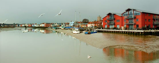
The waterfront is full of character and colour and it is easy to see why this place has become so popular with the artistic community. Sailing boats and fishing vessels line the waterfront watched over by a mixture of quaint old buildings and modern apartments. There is an air of affluence here among the modern waterfront which contrasts nicely with the muddy estuary and the more rustic shoreline.

Wivenhoe


Half way along the front is the Nottage Maritime Museum a fantastic place for learning about boat-building and nautical skills. It also houses an amazing collection of memorabilia relating to the River Colne and is open on most Sundays during the summer months.

As you stroll further along the shoreline you eventually reach the Colne tidal barrier which was built in 1993 to protect the town and surrounding land from tidal and storm surge flooding. It is a huge concrete and steel structure and looks imposing and out of place in its surroundings. Beyond the barrier lies Wivenhoe Sailing Club and an estuary that immediately becomes wild and unoccupied.

Colne Estuary from Wivenhoe Sailing Club


From Wivenhoe the Colne flows through muddy banks alive with the sound of waders, twisting and turning on its journey to the coast.

The bustling town of Brightlingsea lies at the mouth of the Colne Estuary on the junction with Brightlingsea Creek. Although not a large settlement the town has an importance as a port which goes back to the eleven hundreds when the Confederation of Cinque Ports was established. This consisted of 5 towns along the South Coast and 23 connected towns and villages known as" limbs" and Brightlingsea became a limb for the Cinque Port of Sandwich. The Cinque ports were originally formed for military and trade purposes however their significance today is purely ceremonial.

Brightlingsea is a happy place full of activity. It is a town which delights in its connections with the water and the estuary that it sits along side. There is a strong watersports scene here with two sailing clubs and a rowing club situated along the waterfront and a multitude of water based businesses around the town.

Brightlingsea Waterfront


The main harbour lies opposite the town centre and is a hub of activity. To the left of the Colne sailing club is the Aldous Heritage Smack Dock; a site acquired for the preservation and conservation of these graceful working boats.

At the far end of town the promenade, backed by a row of colourful beach huts, leads out to Batemans tower a folly built in 1883. From its position at the mouth of the estuary it is possible to see right across to Stone point in one direction and Mersea Island in the other.

Batemans Tower


Batemans Tower


Colne Estuary Facts

OS Explorer map 184

The Colne Estuary is an important habitat for wildlife and is one of the most protected areas on the East Coast. It comprises a variety of different habitats including:
Tidal mud flats 30%
Salt marshes 25%
Freshwater marshes 20%
Estuarine waters 19%
Sand / shingle shores (including dune systems) 3%
Coastal brackish / saline lagoons 2%
Marine beds (e.g. sea grass beds) 1%

The Colne estuary is an SSSI
Brightlingsea Marshes, East Mersea and Colne Point form part of the Colne Estuary National Nature Reserve.
Colne Point, Fingringhoe Wick and Howlands Marsh are owned and managed as nature reserves by the Essex Wildlife Trust.


Sunday, 2 February 2014

Oulton Broad (Lake Lothing and the River Waveney), Suffolk

Standing on the bridge over Mutford Lock it is possible to look over two very different bodies of water. To the West lies Oulton Broad a vast expanse of fresh water leading to the River Waveney and the Broads whilst to the East lies Lake Lothing a salt water lake busy with shipping and seemingly overwhelmed by heavy industry. Mutford Lock forms the dividing line between these two very different worlds and provides a gateway from one to the other.

Technically Oulton Broad and Lake Lothing are not estuaries and are actually man made features but I have included them because they provide an important and well used access point to the Broads National Park; the UK's largest wetland habitat.

Mutford Lock is a busy place, both on and off the water. The A1117 carries traffic over the bridge whilst pleasure boats traveling to and from the Broads keep the lock in regular use. We strolled around the edge of the Broad from the Wherry Hotel to Nicholas Everitt park. Not exactly peaceful as we never escaped the road noise, but pleasant enough, our entertainment provided by a huge flock of greylag geese keeping busy on the wind blown choppy waters of the Broad.

Mutford Lock, Oulton Broad


Oulton Broad


There is something about parts of the Broads that never feel natural to me, and maybe that is partly due to its man made origins, but also I think it has taken on a theme park feel in places and has somehow lost its wild side. That is not to say that nature is not abundant here, because it is, it's just for me it seems too managed and artificial.

Crossing the road over Mutford Lock and wandering along the shores of Lake Lothing the area feels more raw, much less pretty but somehow more real. Gone are the flocks of geese so domestic in their appearance replaced by more typical estuarine species. Comical turnstones hurrying about their business on the wooden pontoons and a cormorant drying his wings on a post in the sunshine. It felt to me that by just crossing the lock from Oulton Broad to Lake Lothing the wild had returned.

Lake Lothing


Lake Lothing is industrial, there is no getting away from it. The shore is dotted with boatyards and boat builders, engineering works and industrial buildings and the water is full of fishing vessels and working boats. There is a general air of chaos everywhere and decay in places but despite this the place has a certain charm.

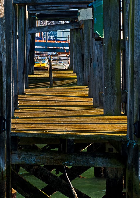
Rickety jetty, Lake Lothing
Lake Lothing continues east from Mutford Lock to Lowestoft where it flows out into the North Sea.

Today Lowestoft is  typical of many seaside towns suffering its fair share of decline and hard times. For despite its long sandy beaches its fortunes have not always been rosy.

The town grew up around the herring fishing industry in the 1800's. In 1830 the harbour was constructed allowing easy access for the herring drifters which worked the East Coast for most of the 19th Century.

The herring fishing industry went into decline at the start of the first world war when stocks began to decline and  most of the fishing fleet was seconded by the Royal Navy. Today Lowestoft still relies on the sea to boost its economy, although now it is the oil gas and wind farms which are the biggest offshore employers.

The town has grown up on either side of the harbour. On the south is the marina, the Royal Norfolk and Suffolk Yacht Club and the RNLI station, whilst the north side is more industrial with moorings for the wind farm catamarans and large shipping.

Lowestoft Harbour


Lowestoft Harbour


Lake Lothing runs out to  meet the North Sea through a narrow harbour entrance flanked by two pagoda type lighthouses, a rather utilitarian entrance in keeping with the waters industrial feel.

Harbour entrance and the North Sea


Lake Lothing and Oulton Broad facts

OS Explorer Map OL40
Imray Chart 2000-10
Sailing Clubs;
Royal Norfolk and Suffolk Yacht Club at Lowestoft
Waveney and Oulton Broad Yacht Club

Tuesday, 14 January 2014

The Stour Estuary, Suffolk

As I strolled along the banks of Holbrook Creek enjoying the weak winter sunshine I noticed something moving on the gravel at the waters edge. At first glance it looked as if the beach was alive, twisting and turning and running from the encroaching tide, but on closer inspection I discovered a flock of Turnstones hurriedly pacing up and down at the waters edge flicking pebbles and bits of seaweed in all directions .

Turnstones at Holbrook Creek
These comical little birds are some of my favourite estuary inhabitants and can often be seen close to shore on a rising tide. They are amazingly well camouflaged thanks to their mottled plumage, but once spotted are easy to watch because they are so tame and it is possible to get almost within touching distance before they fly away. Seemingly undeterred by human presence these little birds are opportunists and I have even seen them being hand fed at Harwich Pier. 

This morning at Holbrook they were behaving true to their name turning stone after stone in search of insects and small crustaceans. I watched them for some time enjoying their antics before leaving them to continue my walk around the creek.

Holbrook is a beautiful and peaceful place devoid of water for much of the day it comes alive at high tide when the tranquil waters bob with little sail boats. Areas of saltmarsh and mutflats edge the creek bounded by high river walls. On the western shore lies the Royal Hospital School; an imposing building designed by arts and crafts architect Herbert Tudor Buckland. The school was originally founded in Greenwich at the turn of the 18th century to cater for the sons of naval men. It moved to its current location at Holbrook in 1933.

The Royal Hospital School looks out over Holbrook Creek.


Holbrook is one of several creeks along the Stour estuary a wide but gentle waterway flowing from Catawade at the head of the navigation all the way to Harwich harbour and the North Sea. The Stour was once an important trade route with barges regularly carrying goods to and from the port of Mistley.

This small town on the Essex side of the estuary has long been associated with barges and barge building and in 1919 the F.W. Horlock Ocean Transport Company opened a yard at Mistley and began building steel ships. In 10 years the yard turned out many barges including the well know vessels Repertor,  Xylonite, Adieu and Reminder. These graceful old ladies are still sailing the East Coast today and are a wonderful legacy to a forgotten era.

SB Xylonite


Although the barge trade may be consigned to the past the Stour is still an important waterway, but it is now one with two very different identities. At its mouth it displays its industrial side with the international ferry terminal at Harwich and its adjacent oil terminal but travel a little further inland and the estuary becomes very much more natural with large swaths currently owned by the RSPB. It is these contrasts which make the estuary so interesting and one of the best ways to appreciate it is on foot following the Stour / Orwell long distance path.

From the marina at Shotley it is possible to walk along the river path past the wide mudflats of Cockle Creek, the vast expanse of saltmarsh at Erwarton Bay and the stony beach at Erwarton Ness before eventually arriving at the enigmatically named Johnny All Alone Creek.

The port of Harwich


Erwarton Ness


Johnny All Alone Creek


The landscape here is flat and the estuary wide exaggerating the distance to the opposite bank. The little creek with its intriguing name is a tranquil place where it is easy to feel at one with the surroundings. I often wonder whether this place is named a after a real character and if so what his life must have been like living in such a remote part of the Suffolk Coast. It is easy to see the attraction today of such an abode; how many of us have dreamed of escaping the modern world to spend our days in a beautiful and uplifting spot such as this? The realities may well have been very different hundreds of years ago but today it is hard to imagine a more perfect spot to escape to.

Stour Estuary Facts

OS Explorer Map 197
Imray nautical chart 2000.5 Rivers Stour and Orwell
The Stour estuary has one marina, 4 sailing clubs and many anchorages between Harwich and Maningtree.
The Stour / Orwell walk is a 42 mile route from Catawade at the head of the Stour estuary to Felixstowe on the Orwell.

Imray 2000.5 Rivers Stour and OrwellImray 2000.5 Rivers Stour and Orwell

Thursday, 9 January 2014

Loch Shieldaig, Wester Ross

Strolling along the shore in front of the main street in Shieldaig village I found several large scallop shells, open and discarded and now half hidden among the boulders and seaweed strewn along the shoreline. Diving for scallops is common is these parts as is creeling for shellfish, but today's fishing is far removed from the industry which grew up here during the 1800's. Then the area was renowned for its herring and the name Shieldaig actually comes from the old Norse meaning Herring Bay.

View from the Applecross Road towards the village of Shiledaig


Shieldaig village was built with grants from the Admiralty who were keen to train seamen to join the Royal Navy during the Napoleonic Wars. The villagers, however, were never called on to fight as Napoleon was defeated at Waterloo in 1815 after which the Admiralty pull their funding from the area and the villagers were forced to return to herring fishing.

The whitewashed houses of Shieldaig's main street


The herring may now be gone but fishing today is as vibrant as ever and concentrates on prawns, nephrops, langoustines and lobsters, mussels and salmon. Spurred on by a love of all things fishy we sought out the Loch Torridon smoke house which is situated in a small garden just off the main street in Shieldaig. All the products here are local and oak smoked and if you love fish it is well worth a visit.

Shiledaig village is a picturesque place with its string of whitewashed houses lining the shore. Probably the best known feature here is Shiledaig Island which sits just offshore from the village. It is a curious rocky mound covered in Caledonian Pine trees and is now owned by the National Trust for Scotland and run as a bird reserve. In recent years it has proved attractive as a nest site for a pair of white tailed sea eagles which have bred here successfully several times.

Shieldaig Island


 To the north of the village is a rocky proprietary which separates Loch Shiledaig from its larger neighbour Loch Torridon. There is a lovely walk which follows the edge of the peninsular and affords fantastic views along the shores of both Loch Torridon and Shieldaig. Following a well worn path we came across two wonderfully isolated cottages,with no route back to civilisation except by sea or on foot. I couldn't help thinking how magical and inspiring this must be; the ultimate retreat for an artist. I suspect the reality however would be much harder than my daydreams suggest.

My idea of an artists retreat!

Looking out over Loch Torridon


Returning to the village we seek out refreshments in Nanny's; a  tearoom and craft shop at the far end of the street. This delightful little building houses an Aladdin's cave of crafts, books and pictures including many stunning images from local photographer Steve Carter.

View from the Applecross Road


Loch Shieldaig Facts

OS Explorer Map 428
Steve Carter also runs a comprehensive website about Torridon and Shiledaig which contains some really useful information if you are planning a visit.


Wednesday, 8 January 2014

Loch Torridon and Upper Loch Torridon

The beauty of the Scottish Highlands especially for a photographer is that you can visit the same place time after time and it will always look different. No matter what the season or the weather conditions the light and the way it embraces the landscape is the principal factor that ensures each visit is a unique experience.

I first came across Loch Torridon a couple of winters ago when I was visiting Applecross. Snow laid heavy on the land as I made my journey along the coast road. The bright white covering helped define the edges of the loch and softened the usually stark monolithic peaks which surround it. The days then were still and bright and unbelievably cold but they were also inspiring and life affirming. Standing at the viewpoint on the A896 looking out over the vast expanse of Upper Loch Torridon and drinking in the amazing view it felt good to be alive.

View across Upper Loch Torridon

I found myself back on the shores of Loch Torridon just over a year later, this time in the summer when the landscape was greener and softer but no less dramatic. I had chosen to stay in the little village of Arrina (or Arinacrinachd as it is sometimes called) on the western shore between Fearnbeg and Kenmore. My home for the duration of my stay was the Old Post Office; a  traditional building with dormer windows and a stunning view over the loch. As its name suggests the building once served as the post office and shop for the whole area; a role it maintained until the 1950's when the whole crofting way of life began to decline and the coastal villages were largely abandoned. It wasn't until the new coast road was built in the 1970's that this process was reversed.

The name Arinacrinachd comes from the Gaelic and means "The Shieling of the Picts". A shieling is a summer pasture and the Picts were a late Iron Age and Early Medieval Celtic people. At the far side of the hill behind the village we found an ancient standing stone, a mysterious relic from times long past, it stood alone and uncluttered in a grassy field surrounded by sheep.

View from the Old Post Office towards Loch Torridon


Looking across the fields towards the loch


Sunset over Loch Torridon


The village of Torridon lies at the head of Upper Loch Torridon. It is dwarfed by the towering peaks of Liathach, Beinn Alligin and Beinn Eighe all of which are over 3000 feet high and are composed of some of the oldest rocks found anywhere in Britain. In summer Torridon is a popular place with walkers and although it can never be described as busy by southern standards it definitely feels less remote at this time of year. If you are interested in the areas wildlife it is worth checking out the Torridon Countryside Centre which stands at the foot of Glen Torridon. We also took time out for refreshments in the Torridon Stores and Cafe which was quite busy but worth the stop.

This year I was back in Torridon again; another winter visit but only a scattering of snow this time. Despite the frequent wet weather this is my favourite time of year by the loch. A sense of  peace pervades and the remoteness feels more intense. It is always possible to feel alone here in this vast expanse of wilderness,but never lonely as there is always so much to see; divers on the loch, deer on the mountains and always a great photographic opportunity just around the corner.


Loch Torridon Facts

OS Explorer Map 428
Loch Torridon is around 15 miles long and was formed by glaciation.
There are several islands within the loch which are:
            in Upper Loch Torridon: Eilean à Chaoil, Eilean Cnapach, both of which are tidal.
            in outer Loch Torridon: Eilean Mòr, Eilean Tioram, Sgeir Ghlas, Sgeir na Trian.

Tuesday, 7 January 2014

Loch Carron, Wester Ross

Standing at the viewpoint on the A890 just outside Strome Ferry it is possible to get a feel for the sheer magnificence of Loch Carron and the mountains which surround it. This is highland scenery at its very best; grand in scale but subtle in detail, a mixture of forest, moorland, mountain and loch.

I had chosen a beautiful day for my first glimpse of  Loch Carron, a still afternoon without a breath of wind, conditions which allowed the varied colours of the landscape to bleed into the water creating perfect reflections. The pale blue winter sky and the depth of the water only added to the intensity of the scene.

View from the A890 looking towards the village of Lochcarron


The River Carron runs through Glen Carron and feeds into the loch at its east end near Strathcarron. The village of Loch Carron lies on the northwest shore; a pretty string of traditional white highland houses, shops and cafes. At two miles from one end to the other this linear village is said to be one of the longest in Scotland. Despite its size (quite large by highland village standards) it is a tranquil place and well worth taking some time to wander around. We found a delightful bistro (the Lochcarron Bistro) along the front serving delicious local mussels one of many mouthwatering dishes on their menu.

Houses on the Lochcarron shoreline


The loch is picturesque in any weather and at any time of the year but winter snow adds an extra dimension to the landscape and the warming colours present at the end of the short winter days are ideal for photography.

Winter at Lochcarron


At the mouth of the loch where the waters meet the sea lies the little village of Plockton. Noted for its unusual palm fringed shoreline (not something you would expect to find in the highlands) this picturesque village is a popular destination for artists.  Some of the houses date back to the 18th century when the village was a busy fishing community. Strung out along the shore line the mixture of white and stone cottages face the loch, separated from their gardens and the shore by the quiet village road. Even in the height of winter these gardens look more tropical than highland with their palm trees swaying in the gentle afternoon breeze.

Plockton waterfront


One of the sheltered bays along the Plockton waterfront


At one end of the village is a little slipway allowing access to the sheltered harbour while at the other end the main pier is the departure point for the summer seal trips which run regularly along the loch.

The Slipway


The main street lies on a small inlet sheltered from the prevailing winds by a peninsular of high ground. It is well worth seeking out the walk which climbs steeply over rocky, boggy ground dotted with rhododendron bushes before eventually reaching the plateau at the back of the village. From here there are stunning views across the mouth of the loch to the mountains beyond. This is an easy place to while away a few hours and although the vantage point is not high by Highland standards it is still possible to feel on top of the world thanks to the stunning views and the wonders of this wild landscape.

View from above Plockton looking out over Loch Carron


Loch Carron Facts

OS Explorer Maps 428 and 429
In places Loch Carron is over 100 metres  deep
Loch Carron lies between the Torridon and Kintail mountain ranges


Wednesday, 1 January 2014

Loch Shieldaig, off Gair Loch, Wester Ross

This beautiful, picturesque but tiny loch is situated along the road to Red Point. It is actually a small branch of Gair Loch but is shielded from the main water by Eilean Shieldaig a small rocky island in the centre of the loch.
Loch Shieldaig and Eilean Shieldaig


At the head of the loch lies an impressive Victorian red sandstone building which was originally a hunting lodge but is now better known as the Shieldaig Lodge Hotel. In the winter the loch is quiet; a few dinghies bob on their moorings, and a sailing boat sits on the beach in front of the hotel, but summer time is different and then the little loch is alive with boats.


The difference in height between high and low water here is 6 meters. At high tide the water reaches the edges of the road walls and there is not much evidence of any shoreline, but when it retreats it reveals beaches of black and grey boulders covered in ochre coloured seaweeds. Herons fish from the shores whilst cormorants try their luck from the centre of the loch.

Cross the road by the hotel and you will find a stream flowing down the rocky slope, under a bridge and into the loch. Trees covered in rich green cloaks of moss and lichens edge the tumbling waterway. These are some of my favourite features of this part of Scotland; bare winter trees in their green mantles products of the pure highland atmosphere.

The hills behind Loch Shiledaig hide the magically named fairy lochs which are notable for their beauty as well as being the crash site of a WWII American Liberator bomber. A memorial to the crew and some wreckage are a permanent reminder of what happened here on 13th June 1945. There are some good circular walks from Loch Shieldaig to the Fairy Lochs.

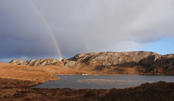
A rainbow over the Fairy Lochs


Loch Shieldaig Facts

OS Explorer Map 434